Australia is about to be hit with three cold fronts that could see snow that stays on the ground and the kickstart to the upcoming ski season. Mark these forecasting sites and uses them for the season.
Weatherzone
Weatherzone.com.au is reporting three distinct cold fronts.
“The first and weakest front will cross Tasmania today, bringing showers and a temperature drop of about two-to-three degrees. The northern edge of this front will also clip Victoria and South Australia, causing a few showers.
Front number two will cross Australia’s southwest tonight before gaining strength over the Bight on Friday and Saturday morning. This system will cross the southeast from late Saturday and on Sunday, producing a burst of blustery winds, showers and snow. This front could bring the coldest weather since last winter to some areas.
Sunday is forecast to be the coldest day since last August or September in Victoria’s Warrnambool (12C) and Hamilton (11C) and South Australia’s Coonawarra (13C) and Naracoorte (13C). Canberra’s forecast top of 11 degrees on Monday would also be its coldest day in nine months.
The third and potentially strongest front of the series will move over Australia’s southeast on Tuesday and should bring showers, strong to gale force winds and more snow.”
[srizonfbvidsingle id=1304390356342422]
Snowatch
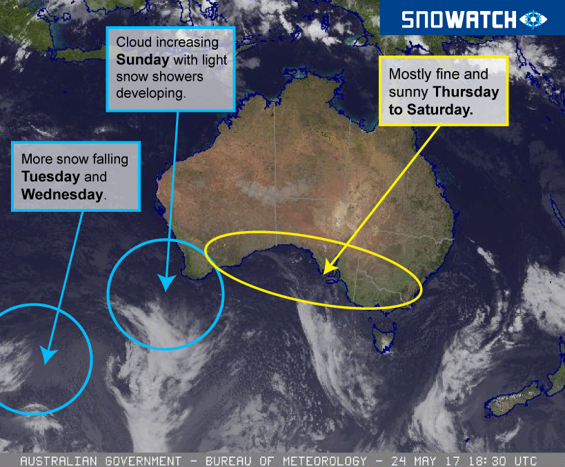
Pete ‘The Frog’ Taylor from Snowatch.com.au has broken down in simpler terms that we can all understand.

The Bureau of Meteorology
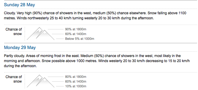
BOM are also predicting snow. The Snowy Mountains forecast calls snow levels between 1400 and 1800 metres which is good for all New South Wales resorts.

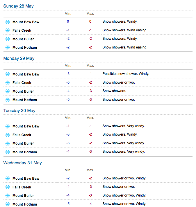
In Victoria’s alpine regions temperatures will dip to as low as minus five degrees Celsius.

Victorian forecaster, Jane Bunn, will also start her regular snow forecasts from May 29. Bookmark her site now.


