New Zealand looks like getting another top up of snow later this week, with rain to start, after their surprise snow fall of the season and early next week is also looking very promising for cold air and low level snow falls.
Australia will get some small top ups of snow today and on Sunday, maintaining the nice spring skiing conditions says meteorologist Alex Zadnik in this week’s snow report.
Australia
A cold front is due to cross the Victorian and NSW alpine resorts today, bringing 1-5 centimetres of fresh snow. Thursday should be a decent day to hit the slopes, with easing winds and some breaks in the cloud.
Friday is looking like a perfect day for spring skiing, with a high pressure system bringing blue skies and light winds. Saturday will be similar, with plenty of sunshine and softening snow as temperatures rise above zero.
A second cold front is due to approach southeastern Australia late on Saturday, with snowfalls developing into Sunday as this weather system moves through. Around 1-5cm of snow is expected in NSW and Victoria with this front, but Mt Baw Baw on the southern side of the Dividing Range could fair a little better due to the favourable southerly airflow in the wake of the front.
A cool to cold southerly airflow will persist into Monday and skies will tend to clear at most resorts.
Another small top up of snow is possible on Tuesday, with the tail end of a frontal system brushing Victoria and NSW as it moves out into the Tasman Sea. A high should then bring a return of mostly sunny skies and lighter winds through the middle part of next week. There are indications that another frontal system will approach Victoria and NSW late next week but it is too early to be sure of what this will produce in terms of snow.
Overall the next week looks like a good one for spring skiing with healthy mid-September snow depths of around 150 centimetres at the higher Victorian and NSW resorts.
New Zealand
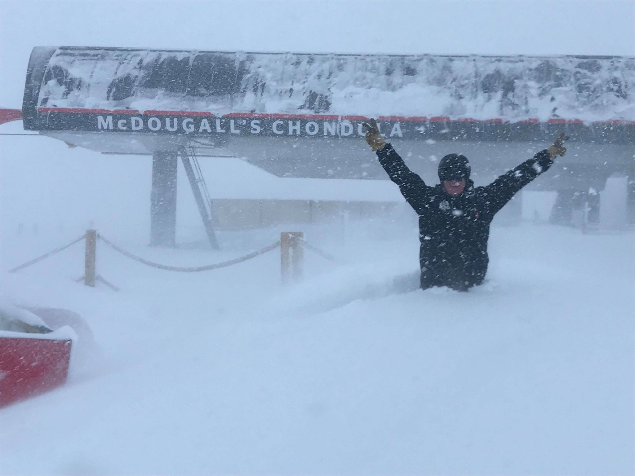
A low pressure system stalled near the South Island from Sunday night into Monday and dumped more than half a metre of fresh snow across the Remarkables, Cardrona, Coronet Peak and Treble Cone.
All of these resorts were closed on Monday as a flow on effect from the heavy snowfalls with the Remarkables and Coronet Peak losing power, but Tuesday delivered the day of the season with fresh powder and blue skies. Areas further north generally missed out from this weather system but Mt Hutt did report 5 centimetres of fresh snow.
A second low pressure system of more tropical origins was impacting northern and eastern parts of the North Island on Wednesday, with areas of rain and stronger winds. Ruapehu was reporting mostly cloudy skies on Wednesday morning but seemed to be missing out on any significant precipitation. Similar cloudy conditions are likely into Thursday as the low drifts away to the east.
The South Island was under the influence of a milder northwesterly airflow on Wednesday morning, so temperatures are expected to rise through the day. This may cause the recent deep snow falls to become slower and heavier through today for skiers and boarders, particularly on the lower slopes.
Thursday is looking like a challenging day for the Southern Alps with strong northwesterly winds and the chance of rain due to the approach of a cold front from the west.
Rain should tend to snow in the evening for the Wanaka and Queenstown resorts, so it might be worth waiting until Friday to hit the slopes.
Weather models are indicating around 5 centimetres of snow from late Thursday into Friday, but up to 10-20 centimetres is possible about the higher runs of Cardrona, Treble Cone and the Remarkables. Weather conditions should moderate for these ski fields Friday, with easing winds and some improvement in visibility.
The North Island will probably see cloud increase during Friday as the frontal system pushes northwards across New Zealand. Around 5 centimetres of fresh snow is possible on Saturday as the front moves through. The South Island should see mostly dry conditions on Saturday, although cloud and winds may increase late in the day with the approach of a significant cold front from the southwest.
This next front looks like sweeping across New Zealand during Sunday and Monday, bringing the prospect of further snow falls into the start of next week. Snow should fall to very low levels around Queenstown and Wanaka on Monday and Tuesday as a bitterly cold southwesterly airflow becomes established.
There is disagreement in the modelling as to how much snow will fall over the Southern Alps during this period, but it does look promising for a decent dump. Keep an eye on the Snowsbest 7-day forecast totals for the Ramarkables, Cardrona and Treble Cone as we edge closer to this date and the modelling firms up on likely snow totals.


