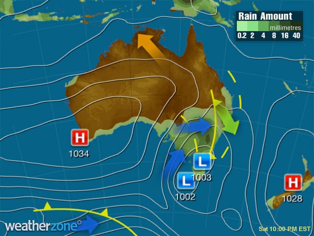
What to expect from the snow storm hype in Australia. Chris Hocking looks into his crystal snow globe.
If you received a fortune cookie at last night’s Chinese take away, it should read ‘Winter is Coming’ or ‘Wax your skis’. It is ON.
While I’m not a professional meteorologist, I’ve made it an obligation as a resort photographer to read into BOM, EC & GFS charts & progressions. The weather in the mountains dictates my movements, so it’s by necessity that I have an rough idea of what is blowing in the breeze.
The snowmakers have done an exceptional job covering the Aus Resorts this holiday period with bases of around 50cm, even a metre on the most popular irrigated runs. Mother nature is about to blast some winter goodness from Friday & possibly not leave until next Friday.
Reminiscent of a later but greater El Nino hombre, 1991 perhaps, we’ll see.
The Main Range (Perisher and Thredbo, Falls Creek and Hotham) are likely to get around 50-60cms on the weekend till Monday. But the good news is there is potential for another 30 – 50cms during the next week till Friday.
It all depends if the second low system stays on track. Jane Bunn from Jane’s Weather seems to think so.
In the meantime, here’s my take.
Friday
Snow has the potential of falling late tonight close to midnight or just after with a northerly wind switching north-westerly on Friday. Generally with northerlies or north westerlies, Northern Vic & Main Range NSW will pick up a little more moisture than in the Southern Resorts.
Expect around 10cm for the day accumulating to around 1400-1500m easing later.
Saturday
The main show arrives beginning with a northerly shifting colder to a north westerly wind in the afternoon. Snow looks to be heavy in the afternoon & evening. 20-30cm possible. Down to 900/1000m.
Sunday
We wake to plenty of fresh snow, the north westerly wind shifts to a south westerley & impacted by another 20cm+. Snow again to low levels 700/800m.
Extended
More snow flurries on & off Mon/Tues with some sunny patches particular in the northern Vic Resorts. There’s the possibility of another snow bearing system 16-18th July onwards, as the snow show rolls on. If this happens we’ll be over a metre of natural snow fall from the fusion of two systems.
Enjoy the turns this weekend & beyond. Aussie snow will be on song!
Believe the hype.
Chris Hocking is a professional photographer & videographer based in Falls Creek Victoria since 2002, having worked in the Australian Snow industry since 1995. Follow him on Twitter & Instagram @hockster111, at facebook.com/chrishockingphotography and @fallsaustralia
Join our SnowsBest @misssnowitall social media chatter on Facebook, Twitter and Instagram.


