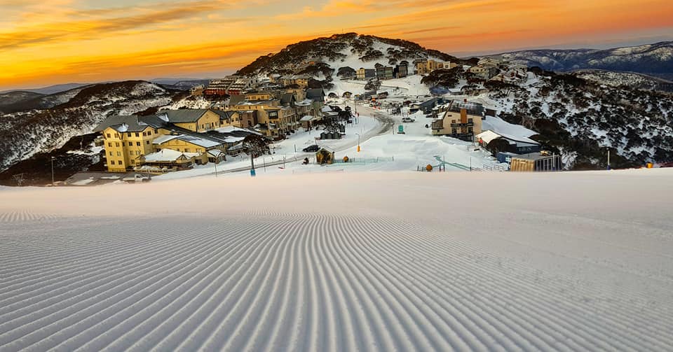
We’re in what we call “the in between”. You know, no huge powder blizzard dumps, no big torrential rain patterns, just cruising along the highway before the t-junction.
Sure, we got some snow last night. Sure, we got some bigger snow the week before. But there’s no big party invites on the horizon for Australia or New Zealand, not until next week anyway.
This week’s snowcial calendar is looking rather empty. Time to work on those carving turns and angulation on piste. You can’t party every weekend, right? That always ends in tears and tears are pretty much water and water is pretty much rain that can turn to snow or not.
We’re rambling now, so we’ll throw it over to our meteorologist, Alex Zadnik, to give you his weekly wrap for the snow outlook ahead.
Some snow ahead for Australia
A cold front delivered snow falls of 5-15cms to the Victorian and New South Wales resorts during Tuesday, with most of this falling last night. Skies are mostly clear today and winds are easing, so it looks like a good day to be on the slopes. The groomed runs remain the safest bet with variable cover and quality off-piste.
The high pressure system responsible for today’s settled weather will stick around for Thursday, so similar conditions will persist across the resorts for most of the day.
Winds may begin to strengthen in Victoria late on Thursday with the approach of a cold front from the west.
Fresh to occasionally strong west/northwest winds are expected for most of Friday as the front moves through whilst weakening. This front should bring a few centimetres of fresh snow to the Victorian and New South Wales resorts during Friday afternoon and evening.
A new high pressure system will bring lighter winds and clearer skies to the resorts on Saturday, so this is looking like a great day for skiers and boarders. Sunday should also be a good day on the slopes, although an increase in cloud is likely, particularly for the Snowy Mountains.
Rain is a risk on Monday. There will be a deepening low pressure trough over mainland Australia drawing cloud and milder air across the resorts. However, this may fall as snow on the highest runs (above 1800 metres).
A cold front passing to the south of the continent should inject some colder air into New South Wales and Victoria from Monday night into Tuesday, but by this time moisture levels will be on the wane, which will probably limit snow potential.
A large high pressure system looks like setting up camp over Victoria and New South Wales on Tuesday and should stick around for most of next week. This means clearer skies and lighter winds for the most part, so days should be nice for skiing and nights will be cold for snowmaking.
Check in with our 7 day detailed forecasts daily.
New Zealand Snow Outlook
As we approach the middle of the season, most New Zealand resorts have a decent base on the upper slopes. The Wanaka and Queenstown ski fields have around 80cm on the upper slopes, while Mt Hutt and Ruapehu are closer to 100cm. The lower slopes could do with a top up though, with the base at around 20cm at most ski fields.
Today (Wednesday 24th July) we have a relatively mild northeasterly airstream across New Zealand, which has formed between a high pressure system to the east and an approaching low pressure system from the west. Cloud will increase during the day and some light precipitation is possible over the North Island. This might fall as rain on the lower slopes of Ruapehu but a few centimetres of fresh snow is possible on the higher runs of Whakapapa and Turoa.
Similar weather conditions are expected on Thursday as the low over the Tasman Sea stalls to the west of New Zealand, as the high to the west acts as a blocking feature. This blocking high will prevent the low from having any real impact on the South Island, but cloud will increase for the North Island on Friday as it moves through.
Light rain may fall on the lower slopes of Ruapehu during Friday and early Saturday, but snow is possible above about 2000 metres.
The South Island should see mostly clear skies on Friday thanks to the high, but cloud will probably increase for the Queenstown and Wanaka ski areas on Saturday with the approach of a weak cold front. Skies should remain clear at Mt Hutt.
The weak front will generate rain across much of New Zealand during Sunday and Monday, particularly for western and northern parts of the nation.
Rain should tend to snow over the lower South Island, with moderate falls possible for the Queenstown and Wanaka ski fields.
Snow is possible on the highest runs of Turoa and Whakapapa but rain is likely lower down. Mt Hutt will be largely sheltered from this wet weather.
There is the prospect that a better snow-bearing weather system will arrive mid next week, although the leading numerical weather prediction models are not yet in agreement on how this will pan out.
Keep an eye on Snowsbest 7-day snow totals in the coming days to see if things are swinging in a favourable direction.


