Sometimes it’s best to just rip that bandaid off when breaking up a relationship, bearing bad news or revealing a less than stellar snow forecast.
So, here goes – expect rain to outweigh snow for the next seven days in Australia.
Ouch, don’t shoot the messenger, we just write the intros for Alex Zadnik our meteorologist who we all know doesn’t mince words (that’s a good thing).
“Rain will outweigh snow in the next 7 days” – well, at least there’s still snow, right?
But then, he’s really a messenger himself delivering what nature has in store.
Got a problem? Rant at the sky. Rant at the sky and remember it’s early days, it’s still only June and snow has a way of curve ball surprising when you least expect it.
Over to you, Alex.
Australia – rain rain, go away, come again a summer’s day
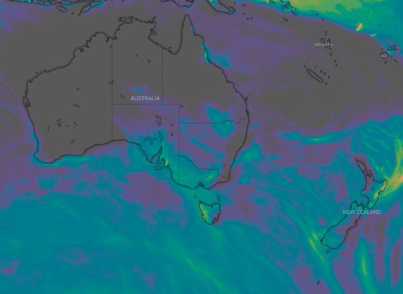
The opening weekend had decent conditions to begin with although cloud did roll in earlier than anticipated on Saturday and stuck around for Sunday. Moderate to heavy rainfall arrived on Monday ahead of a cold front and unfortunately it remained too warm for snow.
Rain is redeveloping today ahead of another cold front, with a mild northwest airstream ahead of this system keeping temperatures well above zero. More than 30mm of rain is expected during Wednesday, which will do further damage to the snow base, as will the warm winds.
A few light snow flurries are possible on Thursday in the wake of the front but not enough to repair the damage of the recent rain.
Some drizzle will probably fall on Friday as the atmosphere warms a little and a humid westerly airstream persists. Therefore skiing options are likely to be limited to snow making areas this coming weekend.
A few light rain showers are possible on Saturday with the approach of a weak cold front from the west. This front should bring some light snow showers to the higher peaks on Sunday but again totals are not expected to be significant. Monday looks like offering clearer skies with a high pressure system moving over Victoria and NSW.
A return of colder, winter-like temperatures is expected mid next week with the arrival of a stronger cold front.
It is a bit early to be sure of snow totals with this system, but it has some promise and should aid snow making activities through the second half of next week.
Check out our 7 day forecasts for Thredbo, Perisher, Hotham, Falls Creek, Mt Buller, Mt Baw Baw, Selwyn and Charlotte Pass.
New Zealand – cold and moist
New Zealand is also encountering some rain at present, particularly across the North Island with the arrival of a low pressure system from the Tasman Sea. Rain should fall as snow on higher parts of Ruapehu (above 1800m) but overall it is not a great system for Whakapapa and Turoa.
Some rain showers are also expected across the South Island on Wednesday before easing on Thursday. Snow falls will be confined to the highest peaks as the airmass isn’t especially cold.
Rain is expected to redevelop across New Zealand’s ski fields on Friday with the approach of a cold front from the west. The good news is that colder air will spread across the nation on Saturday and Sunday, bringing some light to moderate snow falls and better snow making opportunities.
Cold air and light snow showers should linger into Monday before clearing on Tuesday with the arrival of a high pressure system.
There are signs that a low pressure system will bring more rain to the New Zealand ski fields mid to late next week, but this could be followed by some decent snowfalls.
More on this in next week’s update and keep an eye on the New Zealand 7-day mountain forecasts in the meantime.
Bookmark Alex Zadnik’s weekly snow forecasts and stay ahead of the rest.
This week’s weekly weather forecast blog is brought to you by Lotte Arai, Japan’s best free ride resort.
Join our Australia and our New Zealand Facebook chatter groups for real time condition reports.


